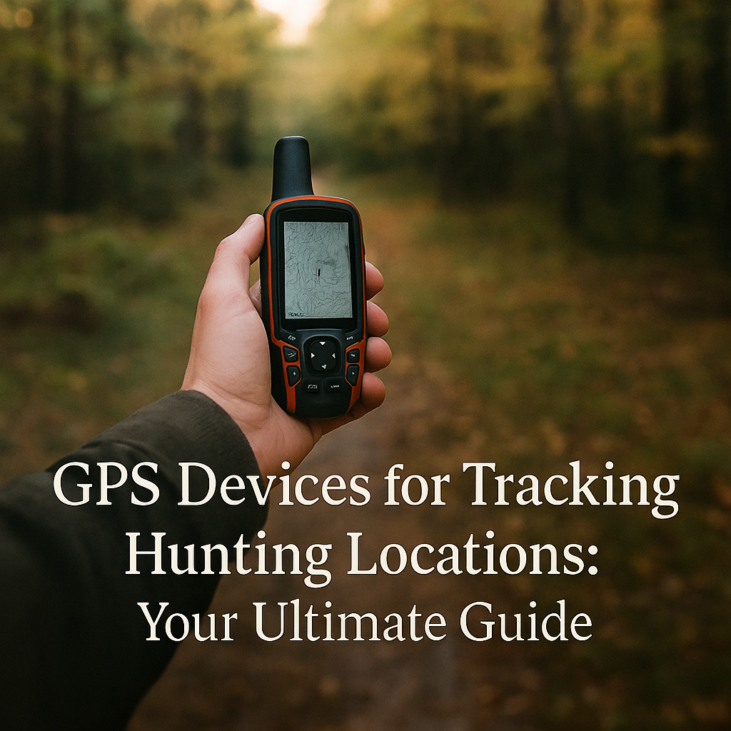
Gps Devices for Tracking Hunting Locations
GPS devices can help hunters mark stands, return to camp, track routes, save blood-trail notes, and avoid getting turned around in unfamiliar terrain. They are useful tools, but they should not be your only navigation plan. Batteries fail, screens break, maps can be outdated, and signal conditions vary.
Table of contents
The best approach is redundancy: use a GPS or hunting app, carry a paper map and compass, preload offline maps, keep backup power, and tell someone your plan before you leave. This guide explains how to choose and use GPS tools without depending on them blindly.
Table of Contents
Quick Answer
A hunting GPS is worth using if it helps you mark locations, navigate safely, and plan routes without replacing basic woods skills. The most useful features are offline maps, waypoint marking, track-back routing, battery life, weather resistance, map layers, and emergency communication options where available.
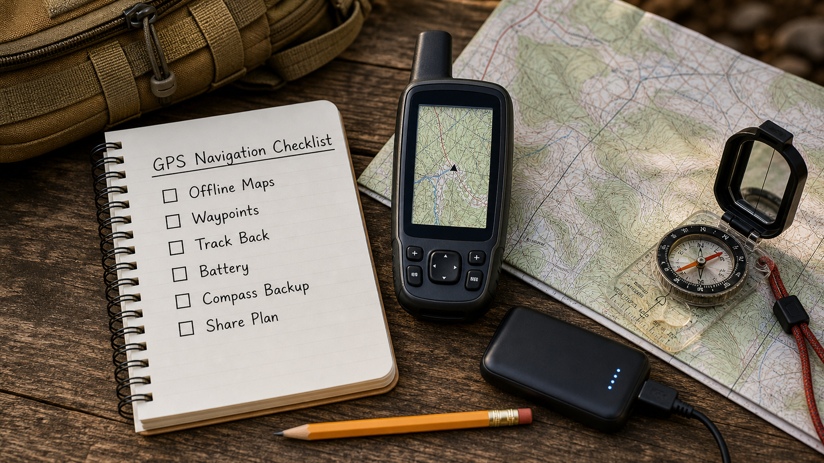
GPS Navigation Checklist
Before relying on any device in the field, run through this checklist. It is simple, but it prevents the most common navigation failures.
- Offline maps: Download the full area before leaving service.
- Waypoints: Mark truck, camp, stand, blind, water crossing, and hazard locations.
- Track back: Test route recording and return navigation before the hunt.
- Battery: Start with full charge and carry backup power or spare batteries.
- Compass backup: Carry a real compass and know the general direction to safety.
- Trip plan: Tell someone where you are going and when you expect to return.
Why Hunters Use GPS
Hunters use GPS tools to reduce uncertainty. A device can help you return to the truck in the dark, find a stand without wandering, mark sign, measure access routes, avoid property boundaries, and record how you entered an area. It also helps when fog, snow, timber, or flat terrain makes landmarks harder to read.
GPS stands for Global Positioning System, a satellite-based positioning system. A basic GPS overview is useful background, but hunters should care less about the technical details and more about whether the device works reliably in their terrain.
Features That Matter
Do not choose a hunting GPS only because it has a long feature list. Choose the features that support your actual hunt.
Offline Maps and Boundaries
Offline maps are critical because cell service can disappear quickly in hills, timber, and remote access roads. Boundary layers can help with public/private land awareness, but you should still verify legal access from official sources because map layers can lag behind current rules.
Waypoints and Tracks
Waypoints mark specific spots. Tracks record your path. Together, they help you understand how you moved through an area and how to return. Use clear names such as Truck North Gate, Creek Crossing, Buck Sign, or Stand 2 instead of vague labels you will forget later.
Battery and Weather Resistance
Battery life matters more than novelty features. Cold weather, screen brightness, route recording, and satellite messaging can drain power. Weather resistance also matters because hunting gear gets wet, dirty, and bumped around in packs.
Types of GPS Tools
Hunters commonly use handheld GPS units, smartphones with hunting apps, satellite communicators, GPS watches, and vehicle-mounted navigation. Each has trade-offs.
Handheld GPS vs. Phone Apps
A handheld GPS may be more rugged and battery-friendly. A phone app may have better map layers and easier planning. Many hunters use both: the phone for detailed maps and the handheld or compass as backup. The best setup is the one you practice with before you need it.
Satellite Communicators
Satellite communicators can add messaging or SOS features in remote areas, depending on device and subscription. Do not treat them as permission to take careless risks. They are backup tools, not a replacement for route planning, weather checks, and telling someone your plan.
Field Workflow
Use a consistent workflow. Before leaving the vehicle, mark the truck, confirm the map is loaded, start a track if needed, and check battery level. During the hunt, mark sign, hazards, trail junctions, and recovery points. After the hunt, clean up duplicate waypoints and save useful notes while the memory is fresh.
Keep your system simple. Too many waypoints can become clutter. Use names and icons that make sense at a glance, especially in the dark or bad weather.
Safety and Backup Navigation
A GPS is only one part of outdoor safety. The National Park Service lists navigation, illumination, first aid, fire, shelter, extra food, extra water, and extra clothes among the Ten Essentials. Hunters should also carry season-appropriate survival gear and know how to navigate without a screen.
For hunting-specific preparation and safe decision-making, resources such as Hunter Ed can help reinforce trip planning, legal access, and responsible behavior. Tell someone your route, expected return time, vehicle location, and what to do if you do not check in.
Common Mistakes
The biggest mistake is assuming the device will solve every problem. Other common mistakes include forgetting offline maps, letting the battery run low, failing to mark the truck, trusting outdated property layers, ignoring weather, and never practicing track-back until lost.
Another mistake is staring at the screen instead of reading the land. Use the GPS to confirm your plan, but still watch wind, terrain, light, trails, and landmarks. A hunter who combines map sense with device discipline is much safer than one who only follows a glowing line.
FAQ
Do I need a GPS for hunting?
You do not always need one, but it is very useful in unfamiliar terrain, public land, big woods, mountains, swamps, or low-light exits. Carry backup navigation either way.
Is a phone enough for hunting navigation?
A phone can work if maps are downloaded and the battery is protected, but it should not be your only plan. Carry a compass, backup power, and basic route knowledge.
What waypoints should hunters mark?
Mark the truck, camp, stand, blind, trail junctions, hazards, water crossings, sign, and recovery points. Use clear names so the map still makes sense later.
Should I still carry a compass?
Yes. A compass and paper map are lightweight backups when batteries die, phones break, or screens become hard to use in weather.
Final Takeaway
GPS devices are excellent hunting tools when you use them as part of a complete navigation plan. Preload maps, mark important points, carry backup power, keep a compass, and share your trip plan. The best navigation system is not the most complicated one; it is the one you understand before the woods get dark.