Random Garmin GPSMAP® 67 Rugged GPS Handheld
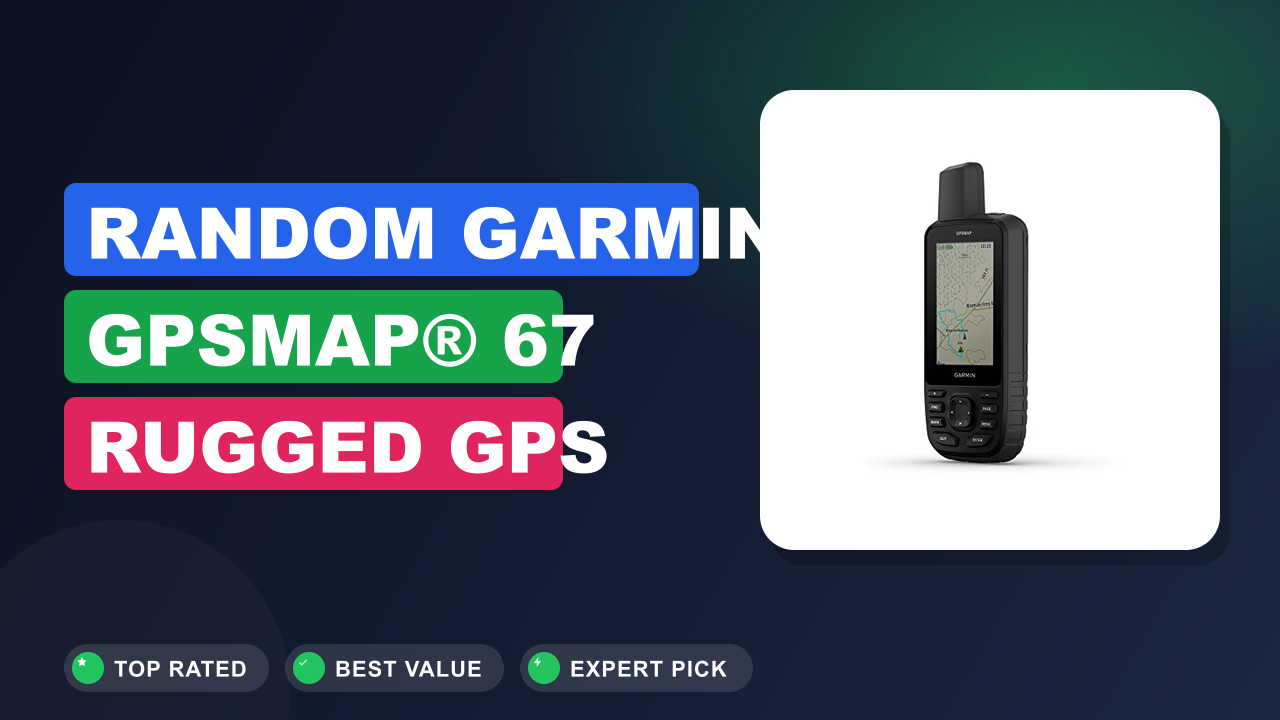
Handheld GPS shopping almost always starts with the same nagging question: is a dedicated unit still worth carrying when your phone already runs maps? The Garmin GPSMAP® 67 is the model that keeps surfacing in that conversation, usually from people who hunt, guide, survey, or spend days past the last cell tower. So our editorial team dug into Garmin's published specs, the manual, and hundreds of verified buyer reports to see whether the premium holds up.
Short version: it's worth it if you need multi-band satellite accuracy and week-long battery away from power, and it's the wrong buy if you want two-way SOS messaging or a touchscreen. Here's the full breakdown.

What it is
A rugged GPS handheld is a dedicated satellite navigation device that fixes your position from orbiting GNSS constellations without any cell signal, then stores it as waypoints, tracks, and routes. The Garmin GPSMAP 67 sits at the top of Garmin's button-driven handheld line, above the entry-level eTrex SE and below the touchscreen Montana 700 series.
Its pitch is narrow and clear: multi-band reception, huge battery life, and preloaded TopoActive mapping in a body you can drop on granite. Rivals in the space include Garmin's own GPSMAP 67i, older Magellan eXplorist units, and Bad Elf GNSS receivers, though most of those either drop mapping or drop the ruggedized housing.
1. Garmin GPSMAP® 67 Rugged GPS Handheld
We compared this unit against the specs of the outgoing GPSMAP 66st and 66sr, and the jump that matters most is the SatIQ power system paired with multi-band GNSS. Aggregate buyer feedback lines up with the datasheet: people upgrading from a 66-series report both better fixes under canopy and dramatically fewer battery swaps.
Setup and first impressions
Expect roughly 20 to 40 minutes before the unit is genuinely trip-ready, and most of that is map downloads over Wi-Fi. The box is sparse: the handheld, a USB-C cable, and paperwork. Verified buyer feedback consistently describes the housing as dense and slightly rubberized, with buttons that click firmly rather than mushing.
The first real task is pairing with the Garmin Explore app over Bluetooth, then letting the device pull TopoActive maps and satellite ephemeris data. Reviewers repeatedly mention that first cold fix outdoors takes a minute or two, after which subsequent locks land in seconds.
A detail that shows up across hundreds of reviews: the 3-inch, 240 x 400 transflective display gets more readable in direct sunlight, the opposite of a phone screen. Backlight off, in full sun, it's perfectly legible.
The common early complaint is menu depth. Owners coming from a phone app describe the first few days as hunting through nested pages for settings like track recording interval and profile switching. It clicks after a week, but it isn't intuitive out of the gate.
| Display | 3.0 in (7.6 cm) sunlight-readable color TFT, 240 x 400 px |
| Dimensions | 2.5 x 6.4 x 1.4 in (6.4 x 16.3 x 3.5 cm) |
| Weight | 8.2 oz (233 g) with battery |
| Satellite systems | Multi-band GPS, GLONASS, Galileo, QZSS, IRNSS (L1 + L5) |
| Battery life | Up to 180 hr GPS mode, up to 840 hr expedition mode |
| Power source | Rechargeable 18650 lithium-ion cell, USB-C charging |
| Memory | 16 GB internal, preloaded TopoActive maps |
| Sensors | Barometric altimeter, 3-axis electronic compass |
| Storage capacity | 20,000 waypoints, 250 routes, 250,000 geocaches |
| Durability | IPX7 water rating, MIL-STD-810 thermal/shock/water |
Daily-use experience
Accuracy and signal lock
Multi-band GNSS means the receiver reads both the L1 and the newer L5 GPS frequencies, which cuts the position error caused by signals bouncing off canyon walls and wet timber. The official U.S. government GPS program documents L5 as the higher-power, interference-resistant civil signal, and that's exactly where the GPSMAP 67 earns its keep.
Where reviewers see the biggest difference is under heavy canopy and in narrow drainages. Hunters and land surveyors report track logs that stay tight on the actual route instead of zig-zagging 40 to 60 ft off-line, which is the classic single-band failure. Boundary-marking users describe returning to a saved waypoint and standing within a few feet of the flag.
On open ridgelines, honestly, a modern phone gets close. The gap widens the worse the conditions get.
Battery and power management
Garmin's SatIQ technology is the quiet headline. It automatically shifts between multi-band and single-band GNSS depending on how difficult the sky view is, so you get L5 accuracy in the canyon and battery savings on the ridge without touching a menu.
Manufacturer specifications indicate up to 180 hours in standard GPS mode and up to 840 hours in expedition mode, which records position at long intervals. Verified buyers on multi-day trips routinely describe finishing a 7-day backpacking route with charge left, something that was never true of the AA-powered GPSMAP 62 and 64 generations.
Real numbers vary with backlight, and that's the honest caveat. Owners who run the screen bright and check the map constantly report far shorter runtimes than the headline figure suggests.
Buttons, screen and glove use
Every function runs through physical keys, and that's a deliberate design choice rather than a cost cut. Wet fingers, thick winter gloves, and driving rain all kill capacitive touchscreens, and the GPSMAP 67 sidesteps that entirely.
The trade-off is speed. Panning across a map with a directional pad is slower than a swipe, and buyers who came from the Montana 700 series say so plainly. Text entry for waypoint names is the worst of it.
The 240 x 400 display is also not sharp by 2026 standards. Map labels look chunky, and contour lines get busy when you zoom out. It's a functional screen, not a pretty one, and the sunlight readability is what you're really paying for.
Build quality and durability
The IPX7 rating, defined under IEC 60529, means submersion in 1 m of fresh water for 30 minutes without ingress. Garmin also lists MIL-STD-810 testing for thermal, shock, and water resistance, which is why this unit shows up clipped to pack straps on rafting trips and ATV handlebars.
Aggregate reviews reflect that. Reports of drops onto rock, days of steady rain, and sub-freezing use overwhelmingly end with the unit still working. The recurring gripes are cosmetic: scuffed bezels and a USB-C port cover that some owners find fiddly to reseat.
One practical note buyers raise often. IPX7 is not a saltwater rating, so rinse it after coastal or marine use.
✓ Pros
- Multi-band L1 + L5 GNSS reception holds position in slot canyons and heavy timber where single-band units wander
- Up to 180 hr GPS mode and 840 hr expedition mode removes the power-bank juggling on week-long trips
- SatIQ auto-switches accuracy modes for you, so you’re not trading battery for precision manually
- Transflective 3-inch screen gets more readable in bright sun, unlike any phone display
- IPX7 plus MIL-STD-810 build survives the drops, rain, and cold that end most electronics outdoors
✗ Cons
- No inReach satellite messaging or SOS, so solo travelers still need a second device or the 67i
- 240 x 400 resolution looks dated next to any phone, and dense contour maps get visually cluttered
- Menu structure is deep and unintuitive for the first week, especially profile and track-log settings
- Premium price tier that’s hard to justify if most of your navigating happens inside cell coverage
Who should buy it
Buy it if you…
You spend real time past the last road: elk hunting in dark timber, running a trapline, marking timber stands, doing utility or conservation fieldwork, or guiding multi-day routes. If your work or hobby involves recording accurate waypoints you'll need to find again months later, the multi-band receiver pays for itself the first time you walk straight back to a marked spot.
It also suits anyone who has already killed a phone or a lesser handheld with rain, cold, or a rock. The IPX7 body plus a 180-hour battery covers a full week without a single charging decision.
Skip it if you…
Your hiking is day loops on signed trails within cell coverage, and a phone with offline maps and a small power bank already does the job. Nothing about the GPSMAP 67 makes a 6-mile state park loop safer or easier, and you'd be paying a premium for accuracy you'll never notice.
Skip it too if you travel solo in remote country and don't already own a satellite communicator. In that case the money is better spent on a device with SOS built in, because rescue capability beats a slightly tighter position fix.
Better alternatives
Garmin GPSMAP 67i is the same handheld with inReach two-way satellite messaging and SOS built in, which is the smarter buy for solo backcountry travel if you're willing to pay a subscription.
Garmin eTrex SE covers basic waypoint navigation and long AA battery life at a fraction of the cost, ideal for casual hikers and geocachers who don't need multi-band precision or preloaded topo mapping.
Frequently Asked Questions (FAQ)
Does the GPSMAP 67 have SOS or satellite messaging?
No. The standard GPSMAP 67 is a navigation-only receiver, meaning it listens to satellites but never transmits. If you want two-way texting and the SOS button routed to an emergency response coordination center, you need the GPSMAP 67i or a separate communicator like an inReach Mini 2.
This is the single most common point of confusion in buyer reviews, so check the model letter carefully before ordering.
Can I replace the battery myself?
Yes. Garmin lists a rechargeable 18650 lithium-ion cell as the power source, and it's user-serviceable rather than sealed inside like some older models. That matters on long expeditions: carrying one spare charged cell doubles your runtime with no power bank and no cable time.
The unit also charges over USB-C, so a solar panel or vehicle port works fine at a resupply point.
Do I need to buy maps, or are they included?
TopoActive maps for your region come preloaded on the 16 GB of internal storage, so it navigates out of the box with no subscription. You can add regional map updates through Garmin Express on a computer or over Wi-Fi directly on the device. Some users add supplementary mapping like BirdsEye Satellite Imagery, which does require an annual Garmin subscription and eats storage quickly.
How accurate is it really, compared to my phone?
In open sky, both land within a handful of feet and the difference is academic. The gap opens in canyons, dense conifer stands, and steep-sided valleys, where reflected signals cause phone positions to jump. Multi-band L5 reception plus SatIQ is specifically designed to reject that multipath error, and buyer track logs consistently show cleaner lines under canopy.
What does the Garmin warranty cover?
Garmin provides a one-year limited warranty in the United States covering defects in materials and workmanship, with regional terms available on the official Garmin support site. It does not cover drops, water damage beyond the rated IPX7 spec, or normal wear. Garmin does operate a paid out-of-warranty replacement program for handhelds, which owners of older GPSMAP units frequently mention as a reason they stay with the brand.
Final verdict
Rating: 4.6/5
The Garmin GPSMAP 67 wins for people whose safety, work, or hunting success depends on a position fix being right in bad conditions and on a battery that lasts a week without thought. Casual hikers and anyone who needs SOS capability should look elsewhere, either down to the eTrex SE or across to the 67i.
What you're buying is a specialist tool, not a phone replacement. The screen is dated, the menus take a week to learn, and the price sits firmly in premium territory. But multi-band GNSS with SatIQ, a MIL-STD-810 body, and up to 180 hours of runtime is a combination nothing else in the button-driven handheld class matches as of 2026.
If that's your use case, it's an easy recommendation.
Affiliate disclosure: This post contains affiliate links. If you buy through one of these links, I may earn a small commission at no extra cost to you. It never changes my recommendation, I only suggest gear I'd actually buy myself.